
In our opinion, Scotland is the most beautiful country in the United Kingdom. There are beautiful mountain peaks, picturesque valleys and wild sea cliffs. It is also home to Britain’s highest mountain and largest lake. But how do you get to know a country that is approximately the size of the Czech Republic? You can find the answer in the title. Let’s walk together on one of Scotland’s most popular long-distance routes and find out how to cross the West Highland Way.
West Highland Way
The West Highland Way (WHW) is without a doubt the most popular long-distance walking route in Scotland and perhaps the whole of Britain. Why not, when it starts on the outskirts of Scotland’s largest city (Glasgow), runs along Scotland’s largest lake (Loch Lomond) and ends under the highest mountain in Scotland and Great Britain (Ben Nevis – 1345 m).
Route
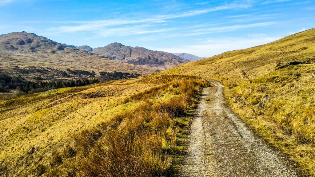
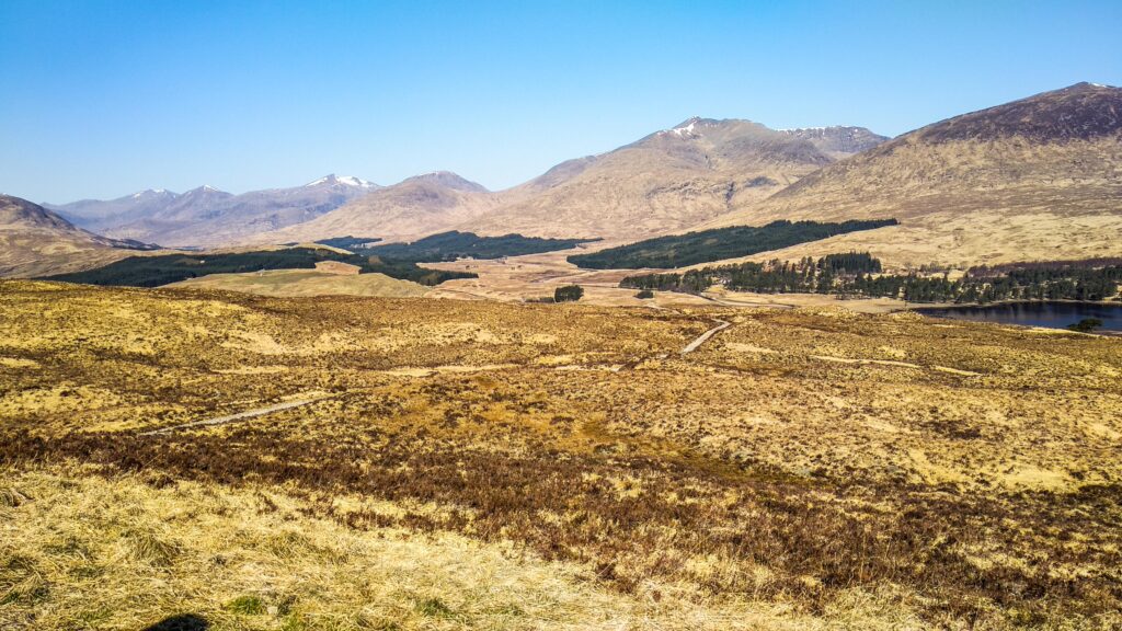
As the name suggests, this route takes you through the western part of the Highlands of Scotland. Its beginning can be found in the town of Milngavie (read mill guy) on the outskirts of Glasgow. It is here that 96 miles (approx. 154 km) separate you from the goal with a total elevation gain of around 2,700 m . The official end of the route can be found in the north of Scotland in the town of Fort William below the highest mountain in Britain – Ben Nevis. Beautiful views of the Scottish countryside, craggy munros (peaks over 3000ft), dark lochs (lakes) and picturesque glens (valleys) accompany you all the way. Of course, there will also be traditional Scottish bogs, streams and forests. And if you are lucky, you will definitely meet deer .
The start of the route around Glasgow and Loch Lomond is relatively flat. However, the trail will gradually “rise”, and therefore it is recommended to complete the transition in the direction from south to north. But there is no need to be afraid. The highest point of the route is only 550 m above sea level, so no big climbs await you. The entire route is on paved, mostly stone paths and roads, and approximately 10% of the WHW is on asphalt. With a few exceptions, these are always footpaths. The route is well marked throughoutWHW inscriptions or thistle symbol (Scottish national emblem). Although you will be walking through typical Scottish countryside, there will be no fording rivers, bogs or getting lost in waterlogged meadows. Everything is properly bridged, the trails are solid (but hard) and you really don’t have to worry about markings (unlike other routes in Britain).
Stages of WHW
150 kilometers is quite a long distance and everyone has to divide it according to their abilities. Most of the time the transition can be done in 6-8 days, but there are also crazy people who can do it in 1-3 days. The ideal time is about a week , during which the stages can look like this:
1. etapa Milngavie – Drymen: 12 miles/19 km
The first stage is such an introduction. You go through the gate at the starting mound and after a short walk through the park you leave the town of Milngavie. You will then pass by the lake and follow the footpath along the road towards the mountains in the distance. One must not be discouraged by the first day . You won’t find many views and the route is not very fast on the endless plains. But you will enjoy it all the more the next day when you leave Drymen in the morning.
Tip: if you want to save on accommodation in Drymen village, you can camp in the forest behind it (approximate GPS: 56°4’55.933″N, 4°26’16.171″W).

Stage 2 Drymen – Rowardennan: 15miles/24km
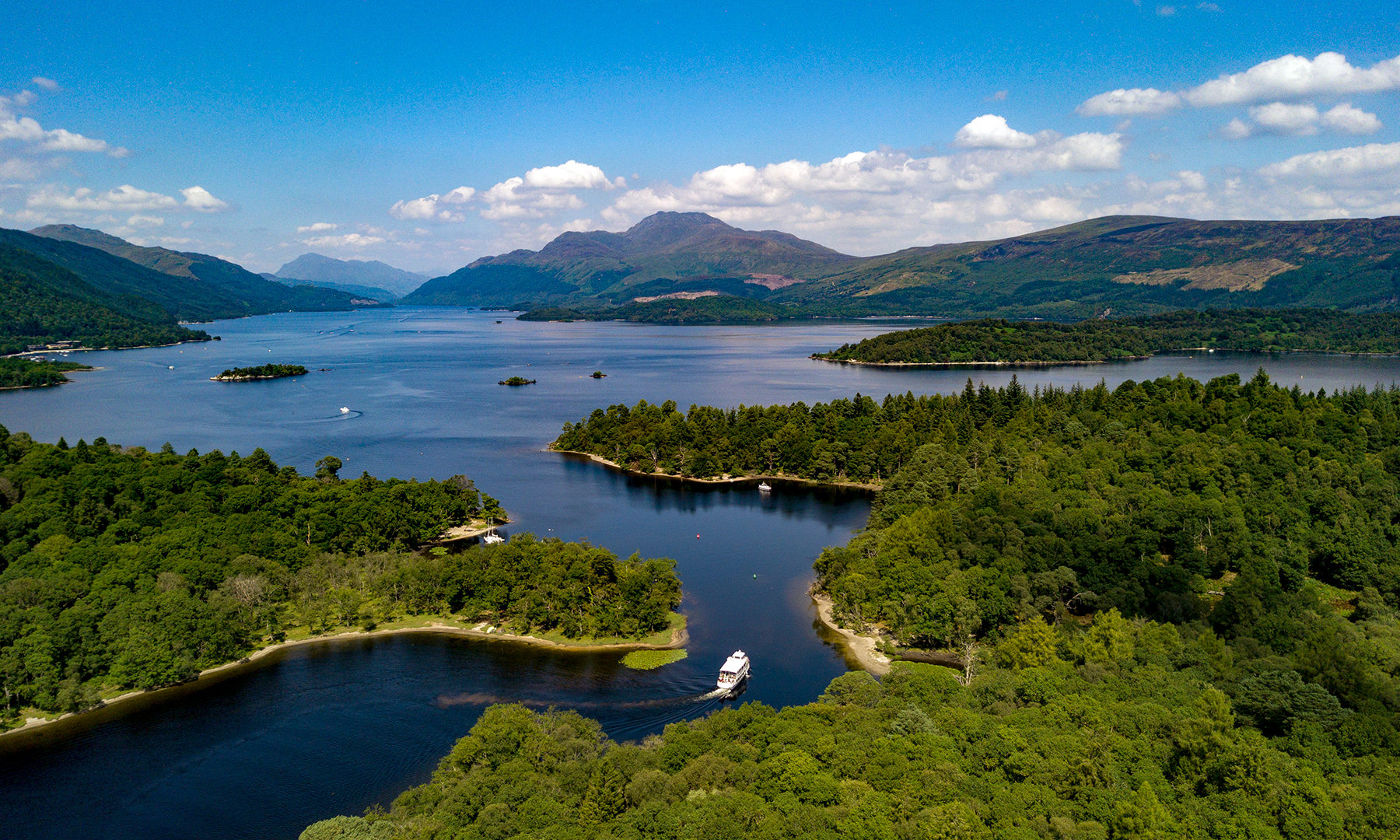
As soon as you enter Loch Lomond & The Trossachs National Park, your first decision awaits you. Either continue along the WHW, or choose its alternative and go to the viewpoint of Conic Hill (358 m). The second option is correct, as the reward for a little climb will be wonderful views of Scotland’s largest lake, Loch Lomond , and the surrounding mountains. You will then spend the rest of the day walking in the forest along the lake.
Tip: alternatively, it is possible to extend this stage by 7 km and spend the night free of charge in the cozy Bothy Rowchoish.

3. stage Rowardennan – Winter: 14 miles/22.5 km
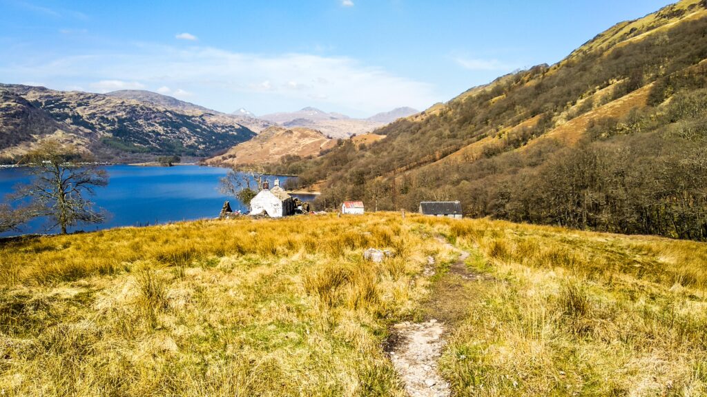
A mentally challenging day awaits you today . On the one hand, the kilometers in the forest along Loch Lomond are not very fast, and the passage from the Inversnaid Hotel, where in addition to a nice view of the lake you will also see a nice waterfall, is quite a break. You will be constantly climbing, descending, and even climbing under trees. But once you get to the second bothy on the whole route (Doune Byre), you’ve won. After a while you will leave Loch Lomond and reach the campsite near Inverarnan.
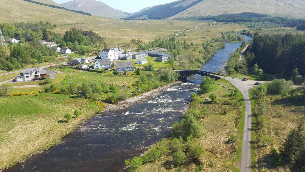
4. Winter stage – Bridge of Orchy: 18.5 miles/30 km
The seemingly most challenging stage is actually pretty cool. It takes you through three pretty valleys with views of the snow capped munros, no challenging climbs, whilst crossing the official half of the WHW (Crianlarich Crossroads). In the village of Tyndrum you can buy supplies at the local gas station and in the evening you will camp on a nice patch behind the bridge in Bridge of Orchy (GPS: 56°31’5.588″N, 4°46’15.144″W).
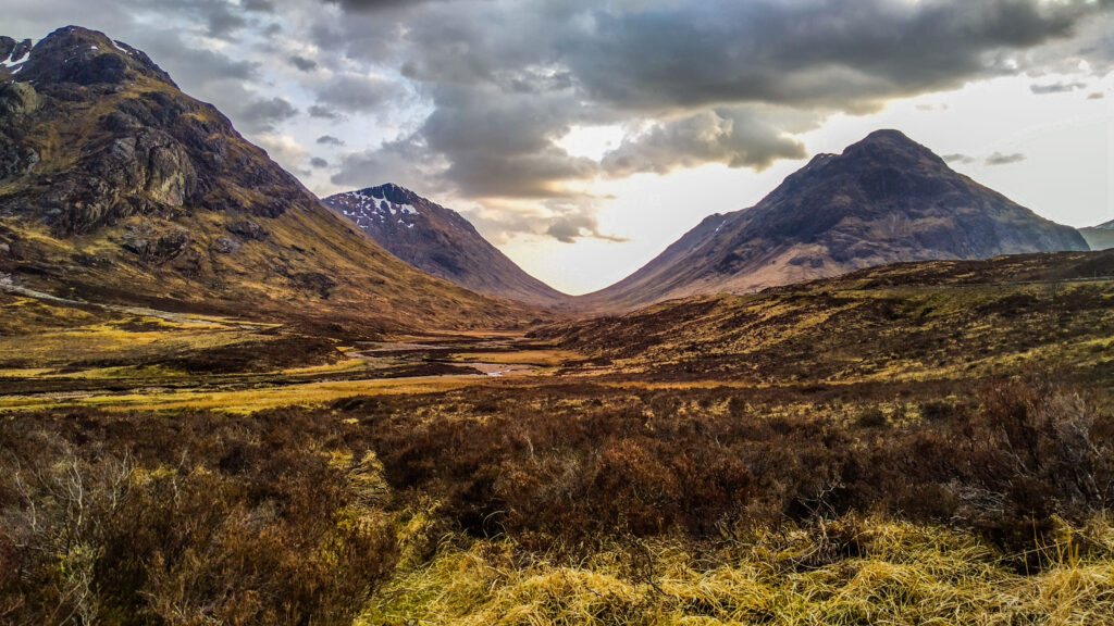
5. Bridge of Orchy – Kingshouse stage : 12.5 miles/20 km
On the fifth day, famous wetlands and swamps await you. Although an old stone path leads through them, so there is no need to wade, but the ubiquitous midges will give you a hard time in the summer . On the other hand, the views here are probably the most beautiful in the whole of WHW and if you’re lucky, you’ll see deer near the Kingshouse Hotel.
Tip: you can find a suitable camping spot right behind the hotel. At the same time, there are free toilets and showers for a small fee.
6 etapa Kingshouse – Kinlochleven: 9 miles/ 14.5 km
Just walk 4 km down the valley from the hotel and you will be under the Devil’s Staircase. This winding trail will bring you to the 550 m high saddle where you will be at the highest point of the WHW . After admiring the views, just descend to Kinlochleven and you are done with today’s stage.
Tip: in Kinlochleven, there is a suitable place for camping, for example here (GPS: 56°42’47.860″N, 4°58’3.148″W).
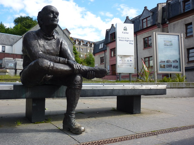
Stage 7 Kinlochleven – Fort William: 15 miles/24 km
Kinlochleven is at sea level, so there is about a 300m climb at the start of the last stage. Then one can enjoy the last kilometers with a view of Ben Nevis and look forward to crossing the finish line in Fort William.

Accommodation, meals and water
As the West Highland Way is one of Scotland’s top long-distance walking routes, there are plenty of accommodation options. We tried to give tips on nice places for free camping, because free camping is allowed in Scotland , except for some places in national parks . However, those who don’t mind paying extra can use a wide range of campsites, hotels and B&Bs. In each campsite you will find a mini-shop where you can buy basic food. For more stocking up, the mentioned gas station in Tyndrum, where they also have outdoor equipment, as well as the Coop food in Kinlochleven, is suitable.
Tip: the emergency shelters (bothies) that are scattered all over Britain are amazing and you can spend the night here for free. You will meet two of them at WHW – Rowchoish Bothy and Doune Byre Bothy. More info available > here <.
Water is nothing to worry about in Scotland . Because of the frequent rains, it is everywhere and the nature here is beautifully clean, so you can pick up practically anywhere. You just have to pay attention to the places where the sheep move and use common sense. If you are ever in doubt about the quality of the resources, don’t be afraid to use the campsites, hotels, public toilets along Loch Lomond etc.
When to go?
When to start crossing the West Highland Way is a rather complicated question. The main season is summer like in most places in Europe, but due to frequent rains, and especially midges, staying in Scotland can be quite challenging. It worked for us to complete the transition at the end of April , when it hardly rained and the midges had not yet hatched, so you could sit outside undisturbed. On the other hand, the night temperatures were around zero and there was snow on the tops of the munros. There are also fewer people in the off-season, but at the same time some campsites and services are out of business.
Transport to and from
Getting to the start/end of the route is no problem. There is a train to Milngavie from Glasgow almost every half hour and you can also take a bus. You can get back to Glasgow from Fort William by train or bus, with the bus usually being faster and cheaper. If you need to finish the West Higland Way crossing earlier , you can hop on a train at Ardlui, Crianlarich, Tyndrum and Bridge of Orchy or a bus at Inverarnan, Crianlarich, Tyndrum, Bridge of Orchy and Glen Coe. To search for a train connection, use the > trainline < app, then you can find bus timetables > here <.
Did you like this article? Do not hesitate to share it on social networks and subscribe to Discover the World on Google News to not miss any articles!